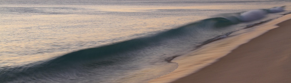
I’m reviewing news items now. James Kim is still missing and I understand they think he’s still in the Big Windy Creek Drainage area near Horseshoe Bend / Black Bar of the Rogue River in the Rogue River Wilderness area west of Galice, Oregon.
Reports here at KGW Northwest news and here at Medford Mail Tribune say searchers found a pair of James’ pants today and continue to track him, thinking he’s probably within 5 miles of where he left the car and family on Saturday morning to find help.
I’m confused at why searchers think he did not make it farther than five miles. Logically if he got to the Rogue River he might have continued along the south bank, knowing that the coast was 2-3 days of (difficult) hiking downriver and would have kept as fast a pace as possible to stay warm. He told Kati he’d return to the car but may have changed that plan realizing that if he’d be maximizing the chance of finding them by trying to hike out of the woods. Riskier for him but giving two chances to be found rather than just one.
There’s a trail on the north bank of the River but not the south bank, and hopefully he would not have tried to cross or run the river using a makeshift raft since there are several dangerous rapids downriver from here.
If James has made it farther than they think, and did stay on the So bank of the River to navigate, he’d probably see the Paradise Lodge which is down near Blossom Bar Rapids on the other side of the River but clearly visible from the south bank. A few miles (I think) down from there on the south bank is Half Moon Bar lodge. With no word yet I’m calling these lodges now to make sure they are fully aware of the situation.

Im looking to help search….any luck finding the right organization ?
Hi Kim
I’m under the impression that the Josephine County search and Rescue has not been asking for volunteers but if you have special tracking skills or knowledge of the area I think you should contact them anyway:
Search & Rescue:
955-5552 and leave a message
Emergency Services Coordinator:
Sara Nicholson at 474-5300
Joe, thanks for the work on this. I’m an expat following the story from the UK.
I agree with you regarding the distance. I was guessing maybe 10-15 miles a day….children and family are powerful motivators. He started at 7:45AM and one would think that “all or nothing instincts” would kick in as he headed off.
Most fit people can walk a mile in 20mins…I figured the terrain makes it harder)….and given the opportunity of 3 days…1 mile an hour x maybe 8 hours a day x 3 days= 24 miles. However, wouldn’t he have come across some type of shelter within 24 miles following along the waterway?
-AC
Sorry–just re-read and noticed your notation about the lodges. Thanks.
AC – I agree this is a reasonable scenario and the answer is no, I think there are no shelters or lodges on south bank until Half Moon Bar some 20-25 miles downriver from Windy Creek.
I’m trying to learn a bit more before I suggest something to the family which would be to get some search volunteers to head upriver from Gold Beach to the Half Moon Bar Lodge and start hiking up the river on the south bank. I called Half Moon a short time ago and learned both they and Paradise are closed, but there are caretakers at Half Moon.
I think it’s unlikely James could have headed south and missed half moon, but this leaves a large area between there and Windy Creek where he could be hung up or hurt. As a smart guy I assume he would have kept the river (which is huge – this is a major river system) in sight rather than trust the roads on which he’d been lost.
I was concerned at the press conference when the police said they did not understand why he’d leave the roads. I think it was because he was following the Rogue River and he left the pants as a sign he was taking that route. The roads had got them lost so he was assuming the River was more a more reliable navigation.
I was wondering why the searchers are concentrating on that five mile mark also—this is just so frustrating sitting at a computer in NC reading this stuff–I can’t stand armchair quarterbacks…but, here I am!
For some reason this story is really gripping to me; I don’t normally obsess about news stories–but, I want this family to be reunited so badly I can’t stand it!
Will continue reading your blog–thanks for updating it!
Steph
Joeduck you are absolutely correct, along with other posters here. James K has a slight build but tremendous determination and could easily exceed this 5 mile ring they’ve decide on. He could also have switched directions so his path is not straight. The best way to find him is via helicopter sight surveillance. Unfortunately, it is not only cold at night but also the food issue is heavy at this point. He could also have fallen and been injured. Sometimes staying in one place and making yourself seen is the best alternative in these situations…
I’ve followed this case from an early point and I’m worried about his survival.
Steph I think a lot of us are in that position. I’m about 2 hours away (by car in summer) from where James Kim is hiking making it even more frustrating. I don’t want to second guess authorities too much, but watching this unfold makes me wonder if search and rescue operations would benefit from a “profiling” approach that tries to guess the likely route rather than wait for the hard evidence.
i am very thankful for the information that you have been posting joe. it’s helped me to communicate back to my friends who are in the area helping to search for James.
I’m not understanding how they figure this 5-mile radius is a good idea. I have to think that your theory is correct. While staying at the car would have been the better option, I can’t blame him for doing what he did.
KathyL – please pass along the possibility of a south bank route where he went more than 5 miles. He was a smart guy and knew that would eventually lead to safety. If injured he probably would have stuck by the river.
I haven’t checked the other comments, but do you think that the tututun logde holds a bit of responsibility in this as well. The map on their site does not show the bear camp road obviously, but they do show the I-5, yet don’t explain to people why not to take that road all the way down to Grant’s pass (leading people to risk the shortcut).
Thank you for posting such detilled info, I have been following this story – I hope we get some good news soon!!
Do you have any idea what could have been the object the sheriff was talking about the latest press conference? Said something about arranging to have it hoisted out. Why did he not come out straight and say what he thought it was? Some of these state guys get so damned puffed up with their puny power positions. deciding what we, the peon citizens, shall hear. Pis*es me off.
The prospects of finding James alive have to be slim. This will be the 4th night out since leaving Saturday. Given that he’d left his wife with the understanding he’d be returning that afternoon, I find it difficult to believe he arbitrarily decided to strike out overland in unknown hostile territory in the faint hope of finding help. Wearing only tennis shoes / jeans, likely soaked, … he’d surely realized staying alive without shelter or warmth for just one night would be a feat.
I’d like to be convinced that bureaucratic bumbling hasn’t significantly hampered this search effort. Why were resources not focused on Bear Creek Rd area a week ago? It seemed the most logical location. Not in retrospect only either. Last week I studied google maps and aerials and thought what could happen on a simple drive from Portland to Gold Beach. Ignoring the possibility of foul play, it was easy to rule out the well traveled routes where if something went seriously wrong help would be available almost immediately from passing motorists. Also any long circuitous route could be eliminated because they had arranged to stay at Gold Beach that night, normally about a 7 hour drive from Portland (where they had lunch). These factors considered, it seemed to me their likely route was via NF 23 and that they likely had run into trouble and were holed up waiting rescue or had driven off the road ending up in a gorge at the bottom of a cliff. That could easily happen to anybody driving an unfamiliar one lane mountain road on a black night in heavy rain and snow. Anyway… I pinpointed on a google aerial what I thought was a likely road location for that kind of possible mishap, and bookmarked it. Turns out that spot is only 4-5 miles from where the Kims’ car was subsequently found.
thanks joeduck for providing a place where i feel i can air my thoughts this saga. the Kims represent to me so much that is good in our world.. I wish them all of my love.
Sara – I don’t think TuTuTun is to blame at all in this case (unless their clerk sent them over Bear Camp, which is very unlikely). I agree with many who suggest the signage is not ominous enough. It’s OK to keep these roads open because conditions change and usually you’d be OK with a 4WD with chains. However the signs should basically say “Chains and 4WD required Nov 1- June 1” or something like that. This would not need to be enforced much but would have given the Kim’s a better sense of the danger. That said I’m not clear why they did not expect pretty bad conditions up there but if James is like me he probably thought he’d get up and over before the road froze. I was surprised how little snow there is up there right now from the TV pictures.
Kip –
No idea and I agree he should share this information immediately. I’m increasingly convinced that if James is alive he is downriver (or perhaps upriver) but NOT in that drainage. The spokesman said he did not understand why he’d drop off the road but I think that is clear – he needed a navigation tool.
Dear Joe Duck,
I stumbled upon your website Sunday, and you made the most sense about where this family might be than anything else I’d found. Then it was proved to be so. (From maps alone — I live in Point Reyes — I’d thought they might be on the Wolf Creek Road.) I agree that a person might decide to stay with the water for navigation and head in one direction along its banks and get more than 5 miles for sure (ruling out injury, disorientation, and so on). We know you can do without food, but you must have water.
Hope we have good news soon. It’s certainly reminded me to keep my emergency car kit (I did once have to sleep in my car because I couldn’t get home during El Nino flooding) in place.
“off the road but I think that is clear – he needed a navigation tool”
And if he had any type of map he knew it was much less of a maze than the roads are up there. And that going down and getting to more water and larger bodies of water only meant that civilization was more likely closer.
Another thing he may have considered. If he could follow the drainage down, which is what drainages do, he would lose altitude and snow and cold. Though I’m not sure how significant the temp drops would be. They would be a step in the right direction in his mind though.
I’m sure from search and rescue’s perspective this is a real pain. They lose the snow foot prints they started with and could have easily used ATV and other vehicles on the roads to cover distances quickly but obviously are stuck on foot going down the drainage.
From the rescuers standpoint it would have been much easier to pick him up on the road, from James it was like no one is using these roads anyway as he well knew since it was obvious no one came by in days.
ZCU – I agree with you, though unfortunately for reasons I don’t understand it’s actually been colder in the valleys several of these nights according to local weather reports. However James would have logically thought lower and valley areas are warmer as they usually are. Also agree that rescuers are frustrated and tired. I think they avoid “profiling” approaches that I think are called for in this case where you have a smart and strategizing guy on the ground.
Kate S – thanks, I sure hope they find him by tomorrow and I’m going to be optimistic. I’ve taken a little initiative on my idea he may be downriver and emailed the family about this. I think the lodge might help putting up volunteers if needed. I know several folks who work or live on this river and they are great people. I’m not clear how thoroughly the River Canyon has been searched, but since the Bear Camp Road does NOT follow the river in this Wilderness region I think it may have skipped the attention paid to other areas.
Yes colder in the valleys :(. Came across the weather forecast at the end of this segment
http://www.katu.com/news/4834331.html?video=YHI&t=a
after posting. And maybe the James and the searchers are just second guessing.
I’m really wondering now about the lighters. If he had lighters shouldn’t it be easy enough to start a fire to keep warm assuming he could find some dry, dead branches. Of course a fire would be a huge help to searchers from the air and on the ground. Why leave just a pair of jeans when you can leave a fire ring smoking?
Another good video. The pilot who found them describes the logic of his search from knowing the area:
http://www.katu.com/news/local/4838026.html?video=pop&t=a
I sure hope your initiative and intuitions are as key as his.
why couldnt it be foul play? what if something did happen? maybe he left them there or she did something to him, wouldnt it make sence to back track and head out on the road you came in? i thought they got stuck in the snow and not lost on the road…why did he take 2 lighters? are they heavy smokers? did he leave a lighter for her and the kids? if i was in the snow and cold the last thing i would leave as a marker would be my pants. do they even know for sure they ARE his pants? any ID papers anything????
the whole story isnt adding up either something happend or the guy isnt as bright as ppl think, after all…. if he would have stayed with his wife and kids he would have been found too
I can assure you there is no foul play here. Kati didnt do anything to him. Anything along those lines is the furthest thing from the truth. He took 2 lighters so he could try to make a fire to stay warm.
Foul play? Sounds kind of creepy Jette. But for all the intrigue, does it really make any sense when you think it out rationally?
You seem to suggest he left them there to die. If that was your plan why would you come so ill prepared and risk your own life in the process? Why strand yourself in a place that could easily take your life too?
Her doing something to him? Like what and how? Do you think the police are covering up that there were really two sets of footprints leading away from the car and that she shoved him into the drainage area? And of course how far would she go down that drainage to do her dirty work. Did she plant the muddy foot prints past the snowline too?
Why track back on a road system that already got you lost in the first place? Seeking waterways when lost in the wilderness is not bad advice. And in wilderness areas like this roads are often built parallel to the rivers and streams anyway so maybe the possibility of getting to a road that had traffic, unlike the road they had been sitting on with no traffic for days.
Not his pants? Why not? Who else is out there traveling a trail-less and dangerous drainage? The wife’s hired killer who leaves no foot prints and no other tracks and leaves the woman who hired him up there to die in the cold too? Ever walked in wet jeans? Know how useful they are once soaked? Know how long it takes to dry them in a heated, tumbler dryer even?
Two lighters. A husband and wife that smoke. Not so unusual considering that 1/4 to 1/3 of the population smokes.
He was taking the lighters from her and the kids as part of the plan for them to freeze to death? What’s it matter since you burnt all the tires and food’s short anyway. Plus the car probably has a lighter that could be heated up with whatever juice was left in the battery.
And how bright is he for leaving? Because if he only stayed he would have been found you are saying. But would you stay if you were stranded for days and hadn’t seen a soul and were out of gas, things to burn, and food? Why is it “bright” to stay with a track record up there like that? Sure if you could say “well I know they will find us on this day” it would be stupid to leave. But wouldn’t such difficult choices in life be easier for all of us if we knew for sure what would happen when? The bottom line is we don’t and we weight cost and benefits and probabilities.
Sorry Jette, the conspiracy logic may be intriguing, but it just doesn’t add up when you really think it through. The more logical story is they made a couple bad turns, got lost and stuck in the wilderness, and after days of being stranded with no sight of help he figured that he ought to get out and look for help as the only possibility that he and his family would have a shot of surviving. He took those things he could that would be of most benefit to his situation of traveling like the lighters because that was the best chance for all of them to survive. Not some lucky chance of a car or something coming by in the next day or so.
Duck , get with me when u can > asap
i need to get cued in with local maps.. but will
probably find by time u can reply lol……. thanx for your efforts…. get a dowser in there !
Geodowser the Google online mapping of the area is very good and the Google Earth program, a free download, allows you to view the topography and do a “fly over” of the area.
Also there are several comments in earlier posts with mapping information for this area but I have not been able to pull all that together yet.